Sunday, June 22, 2014
Pine Buff, Arkansas
Author’s Note:
Some stories can and should be twice-told and this is one of those. It starts in 1815, develops and then lies fallow until 1921 when two county judges in Arkansas get into an argument — and then it cranks up again. It comes to a conclusion in June 2010 when I write it for the first time. We are now exhuming it from the files for a second life. If you like history, you will like this story. If you do not like history, after reading this story, you probably will — or at least gain tolerance for historical musings.
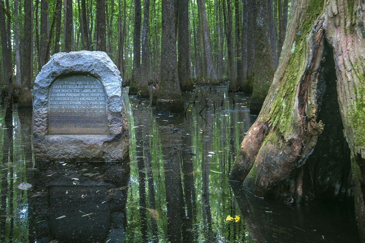
The picture of the monument is unusual in that you are seeing it at about knee level. Under normal circumstances, you would get this view only by standing in swamp water. I shot it high and dry and got the same knee-level view. Read the “notes” at the end of the story for the simple solution.
Thanks,
Joe Dempsey
PS: The story continues at Weekly Grist for the Eyes and Mind, where you will see a closer view of the monument plus a glimpse of surrounding territory.
The Baseline
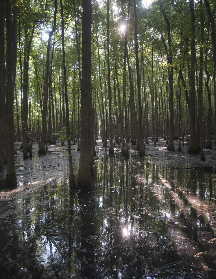
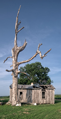
Looking west (the monument is behind you), you can see the baseline running through the trees. Theoretically, were you to start off slogging west along this trace, you would eventually set feet on Baseline Road in south Little Rock, portions of which run along the baseline. Now you know where that sucker got its name.
They Had to Start Somewhere.
First Published on Sunday, June 20, 2010
Pine Buff, Arkansas
Sometimes a controversy or the results thereof are not a bad thing. Such is the case with the monument above, which is where it is because of a disagreement over the exact location of a section of county line dividing Lee and Phillips counties in Arkansas. It was 1921 and officials of both counties decided a survey would resolve the disagreement.
As a result, the powers that be hired two surveyors, E. P. Douglass and Tom Jacks, to venture into this fetid Delta swamp and find the exact location of the county line. In so doing, they happened across the handiwork of two previous surveyors, Prospect K. Robbins and Joseph C. Brown, who did their work in the same territory in 1815. They were plying their trade at the behest of then President of the United States, James Madison, husband of Dolly, of White House, and now, cupcake fame.
President Madison commissioned Robbins and Brown to establish an initial point from which the recently acquired Louisiana Purchase would be surveyed. The idea was to find a couple of known points to establish a new one. The north-south line is called a meridian and the east-west line is called a baseline. Where the two lines cross is the new point from which surveys may be made. Robbins surveyed north from the junction of the Arkansas and Mississippi Rivers. Brown surveyed west from the mouth of the St. Francis River.
Robbins and Brown did not meet at the actual point on their first pass. Brown passed the point first. On November 10, 1815, Robbins crossed Brown’s tracks and sent some of his minions to backtrack, find Brown, and bring his party back to the now discovered initial point. Their reunion happened in the neighborhood of November 24, 1815. They proceeded to hack slash marks in a couple of gum trees to mark the historic confluence of meridian and base line.
Fast forward to 1921. Douglass and Jacks are slogging through the swamp when to their surprise they find the trees marked by Robbins and Brown 106 years earlier. Reportedly, Jacks’ exact words at the discovery were, "By all odds of probability, this has to be the original point for the Louisiana Purchase survey." He could not have been more right. While it is hard to be elated when standing knee deep in a swamp, I strongly suspect that's how the two intrepid surveyors felt.
The L'Anguille Chapter of the Daughters of the American Revolution, not missing a chance to do something good, commissioned and installed the monument at the spot in 1926. The site is now listed on the National Register of Historic Places and is the location of the Arkansas Louisiana Purchase State Park. Visitors to the park today — unlike Robbins, Brown, Douglas, and Jacks — can visit the spot high and dry due to a well-constructed and nicely maintained elevated boardwalk.
The significance of the starting point may be lost on most folks, but virtually every property line in all of Louisiana, Arkansas, Missouri, North Dakota, South Dakota, and Oklahoma — and the biggest parts of Kansas, Colorado, Wyoming, Montana, and Minnesota — are based on this point. Thanks to a squabble between a couple of Arkansas county judges, we know where it is.
Sources for this story:
http://www.surveyhistory.org/ louisiana_purchase_state_park1.htm
and
http://encyclopediaofarkansas.net/ encyclopedia/entry-detail.aspx?entryID=2204
plus some information from park signage.
Nikon D7100, hand held, ISO 200, set to program mode. The camera selected apertures from f9 to f11 and speeds from 1/320 to 1/500. Post processed in Photoshop CC.