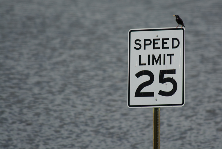
This blackbird, perched on a sign at the entrance to the Pine Bluff Jefferson County Regional Park, seems to be registering his displeasure over the very wet fact that his blackbird smorgasbord of insects and worms is inundated.
Sunday, June 7, 2015
Pine Buff, Arkansas
Like many other parts of our nation during the last couple of weeks or so, LA (Lower Arkansas) has been well soaked. Not only have we been pelted by gullywasher rains, we also suffer from the vagaries of geography. We are perched on the lower end of the Arkansas River, not too far from where it dumps into the Mississippi River. With the rain falling almost everywhere upstream, we have become the unwilling recipients of everyone else’s downpours.
And, since the Arkansas River starts in Colorado, it has picked-up a good head of steam by the time it gets here. Flood stage is 42 feet. We were gurgling between 45 and 46 for several days. As of today, we are 41 feet and some change.
I sallied forth on May 29 and May 31 when the river was at 45 feet, so all of the pictures you’ll see in this epistle are about one-foot shy of where they were when things peaked out.
On the Rise
This is the north end of the U.S. Highway 79 bridge over the Arkansas River north of Pine Bluff, Arkansas, shot on May 29. At this point, the river was about 45 feet. Eventually the water would inch up to 46 feet. The number on the scale on the bridge pier tells river pilots how much clearance they have under the bottom of the bridge structure.
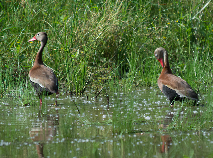
New Waters
Two geese forage around in a new mini-pond under the bridge, which under normal circumstances is dry.
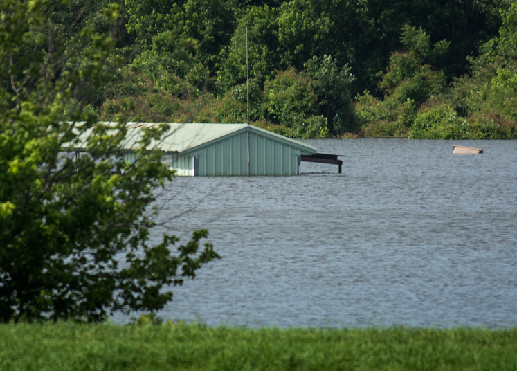
All Flights Grounded
This is the hangar/pavilion for Pine Bluff radio controlled aircraft enthusiasts near the entrance to the Pine Bluff-Jefferson County Regional Park. The water would rise one more foot to just under the eaves.
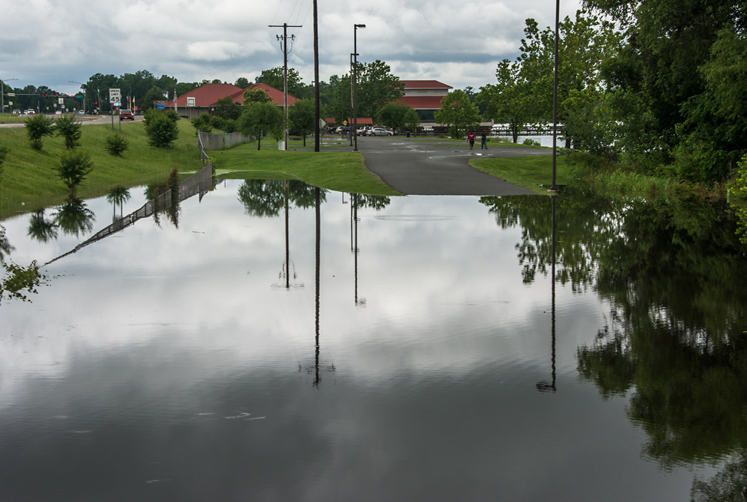
Boats Only, Please.
The entrance to our park. A couple of days later, the grass and asphalt in the foreground would be under water.
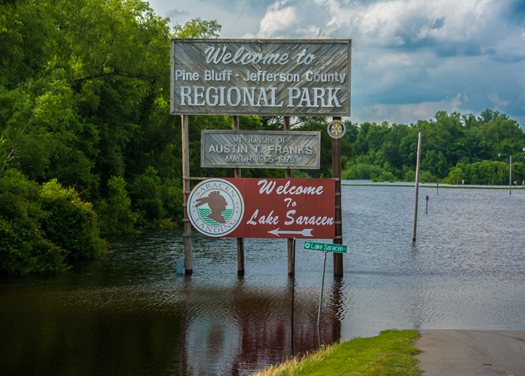
No Passage Today
Saracen Landing on Saracen Lake is in the background. The pond in the foreground is normally a connecting road between the entrance to the Pine Bluff-Jefferson County Regional Park and the Saracen parking lot.
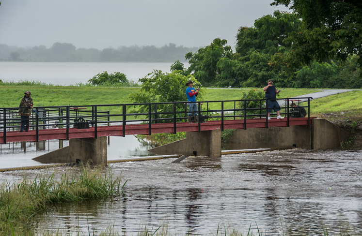
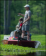
Rain? No Problem! Let's Fish.
The overrunning spillway of Saracen Lake has attracted a few anglers who do not seem to be concerned at the light falling rain in which they are standing.
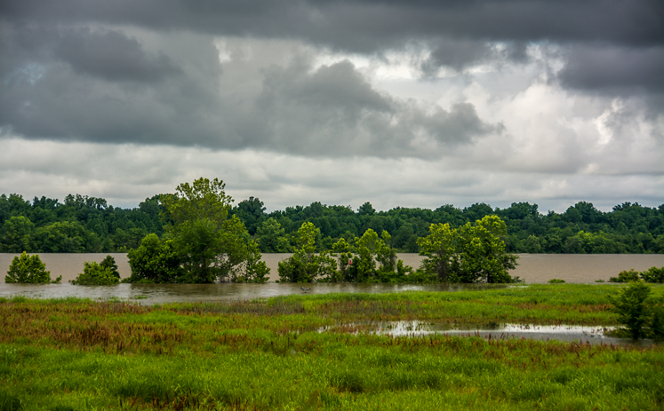
When the Channels Merge
Lake Langhofer, AKA the Pine Bluff slackwater harbor, as seen on May 31, 2015. The harbor was formed during construction of the McClellan-Kerr Arkansas River Navigation System. This is the former main channel of the Arkansas River. The river was rerouted during construction. At this point, the river and the harbor were functionally one. Look closely and you’ll see a Great Blue Heron at the water’s edge just above the grass. Shot from a road on the levee.
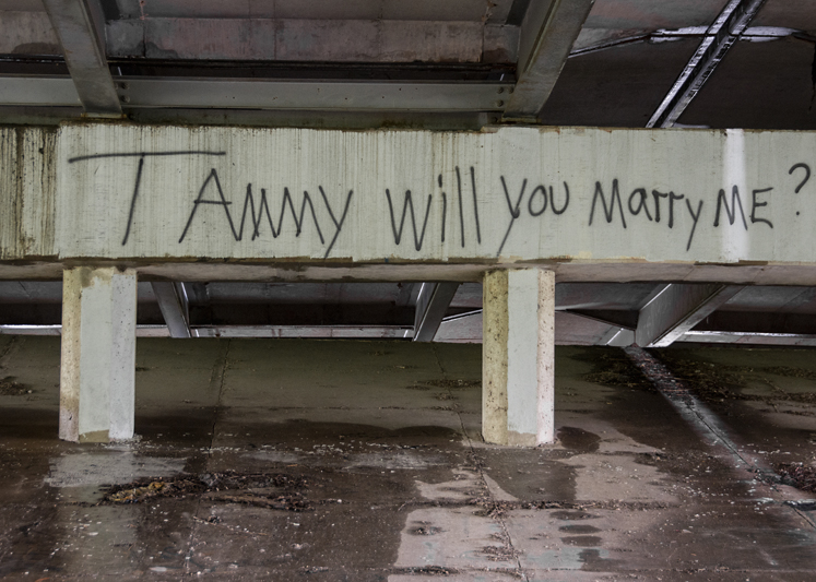
Can't Wash Away Love
The levee road at one point runs under U.S. 65B here in Pine Bluff. Under the overpass, I found this poignant supplication. Wonder how Tammy answered? Go figure.
We would be derelict if we did not include one of LA’s finest (he was born in Kingsland, Arkansas) bemoaning waters that are five feet high and risin.’