


About the Glossary and Compendium:
The Index to Entries displayed on the right side of this page features titles and links to the corpus of the Glossary and Compendium. Many of the entries reside at their own webpage. A few are part of the running commentary displayed below. We can't say why any of the entries exist here. But they do, and probably shall continue to exist here — for so long as the electricity flows, the webmasters keep command of their faculties, and the means of production are available to us.
In keeping with CornDancer's policy of open access, readers are invited to submit entries for inclusion in the Glossary and Compendium. Photographs and commentary about the photos are most welcome. Drop us a line any old time at threadspinner@corndancer.com
Crow's Cottage is spun on three webs: Letter to Crow's Cottage, Journal to the Corvus, and Crow's Cottage Glossary and Compendium. The three are designed, edited, and managed by Ebenezer Baldwin Bowles, a denizen of the World Wide Web. All three Crows are blood-kin within the CornDancer family of webs.


![]() Government's antidote to the ravages
Government's antidote to the ravages
of unbridled agricultural capitalism in the early decades of the twentieth century, the national grasslands of the USA demonstrate the value of central planning and social action for the common good. Developed by the Soil Conservation Service in the late 1930s, the grasslands program sought to reclaim the raging, barren Dust Bowl lands of the Great Plains for productive use by farmers and ranchers. After seventy years of sensible management, the program is measurably successful, having returned four million acres of previously worn-out land to productive use for livestock grazing, recreation, hunting, watershed stabilization, and wildlife preservation.
As one of many programs designed by the Roosevelt administration to mitigate the miseries of the Great Depression, the grasslands initiative saw the federal government purchase eroded private land from failed, bankrupt farmers and ranchers, or from the banks that held the worthless deeds. The land was taken out of cultivation and nursed back to natural health, then gradually returned to sustainable use. Management of the national grasslands was transferred to Forest Service in 1953.
The Black Kettle National Grasslands encompass 30,724 acres in west-central Oklahoma near Cheyenne and an additional 576-acre tract near Canadian, Texas. The grasslands' namesake, Chief Black Kettle of the Southern Cheyenne tribe, is memorialized at the Washita Battlefield National Historic Site just outside the town of Cheyenne. Groomed trails meander through the 315-acre battlefield site to provide visitors with the opportunity to see the grasses, wildflowers, trees, streams, and critters of the grasslands — up close and personal. A sense of peace and dignity is offered by the Creator to a sensitive visitor — testament to the spiritual power of Chief Black Kettle, who died there defending his family against attack from Colonel George Armstrong Custer's Seventh Cavalry Regiment of the United States Army during the long Indian Wars.
EBB — July 3, 2009, and August 20, 2012
![]() Washita Battlefield National Historic Site
Washita Battlefield National Historic Site
![]() The Crow's Cottage librarian recommends
The National Grasslands: A Guide to America's Undiscovered Treasures by Francis Moul with photography by Georg Joutras (Lincoln 2006: University of Nebraska Press).
The Crow's Cottage librarian recommends
The National Grasslands: A Guide to America's Undiscovered Treasures by Francis Moul with photography by Georg Joutras (Lincoln 2006: University of Nebraska Press).
![]() Blood: at Beautiful Cheyenne, Intimations of Legend Ride the Western Wind.
Blood: at Beautiful Cheyenne, Intimations of Legend Ride the Western Wind.

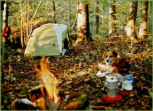
![]() A good dog.
A good dog.
Mix of Chow, Collie, and Saint Bernard. Found as a pup, wandering with his two sisters in the woods outside Conway, Arkansas, by Deb Strack in the spring of 1996. A gift to the family Bowles. Nicknames: Chi Pup, Root Man, Buckaroo. Buck died on August 31, 2009.
![]() The Journey Ends. Bye, Buck Bowles.
The Journey Ends. Bye, Buck Bowles.

![]() 15-mile rugged trail
15-mile rugged trail
that begins in Devil's Den State Park in Arkansas, enters the Ozark National Forest, and returns to its starting point in the park. The trail is named for the Butterfield Overland Stage, a stagecoach route from Missouri to California that ran from 1858 through 1861. A stout challenge for the hiker who wants to go from beginning to end in a single day, the trail meanders along Lee Creek in the state park, climbs Olive Mountain, descends to Blackburn Creek, and traverses the mountain again, returning the weary hiker to Lee Creek and the trailhead in Devil's Den. It's an ideal two-day hike for the backpacker who is eager to get away from it all, but not so keen on having to backtrack or navigate the deep wilderness.
![]() Butterfield Trail map and narrative description
Butterfield Trail map and narrative description
![]() Into the Wilds: Shelter in the Eternal Night.
Into the Wilds: Shelter in the Eternal Night.

![]() An experiment in land management,
An experiment in land management,
Callie's Prairie is a 35-acre tract .... symbolic of a movement .... to restore by destroying ... near Lake Fayetteville in northwest Arkansas .... "...being restored to more closely resemble the way it looked when Thomas and Callie Henson bought the land shortly after the Civil War," Bill Bowden wrote (Arkansas Democrat-Gazette, 21 October 2012).
Collaborative effort between environmental groups and the city of Fayetteville. Controlled burns, cutting of trees including thousands of cedars, according to Joe Woolbright of Siloam Springs, board member of Fayetteville Natural Heritage Association (NHA) and director of the nonprofit Ozark Ecological Restoration Inc. Also involved are David Chapman, member of the NHA; Bob Caulk, chairman of the NHA; Audubon Arkansas; and Northwest Arkansas Audubon Society.
R A W N O T E S :
Bowden's story states: "Woolbright said it will take about five years to get the prairie looking the way they want it to. That's because native species of grass and flowers have been planted in parts of the prairie, and it will take them that long to fully grow. Also, controlled burns every two or three years will destroy invasive species of plants and resuscitate the dormant seeds of native plants. The invasive grass Serica lespedeza is the biggest problem at the prairie, he said." Woolbright said there are 20 to 30 species of grass at Callie's Prairie. Historically, there were probably more than 500. "Arkansas prairies became woodlands and forests in large part because of fire suppression efforts in the 20th century," Woolbright said. Woolbright mentions explorer Henry Rowe Schoolcraft's visit to Arkansas in 1819. "Schoolcraft wrote that you could ride a horse at a full gallop all the way through the Ozark Mountains," Woolbright said. "It was like a park. ... It was much more open historically than it is now." Woolbright said he knows of "only about 125 acres of virgin tall-grass prairie land remaining" in Washington and Benton counties, whereas there used to be 100,000 acres. Bowden writes: "Virgin tall-grass prairie refers to land that has never been plowed. The biggest part of that is the 83-acre Chesney Prairie near Siloam Springs." One goal is to "bring the prairie birds back."
Crow's Cottage sent an inquiry to Joe Woolbright by e-mail express on 2 Nov 2012, but Joe ignored us. We were nice, too, asking for a list of the “20 to 30 species of grass” and some more information about the history of the tract. We suppose he's too involved in overseeing the destruction of thousands of eastern red cedar trees in the altruistic pursuit of restoration. In current jargon, the term for the destruction of the cedars is "selective eco-restoration."

![]() "One for the cutworm,
"One for the cutworm,
one for the crow, one to share, and one to grow." So reads the folksy aphorism topping the pages on the web of Conserving Arkansas's Agricultural Heritage (CAAH). The "one" in this instance is a seed — and not just any seed, but heirloom seeds, passed down by gardeners from generation to generation, the kinds of seeds that "carry with them genetic diversity and long-standing traditions" to "support and reinforce culture," according to the CAAH web. The program manages a central seed bank and a seed information archive devoted to preserving the sustainability and history of heirloom seeds at its headquarters on the campus of the University of Central Arkansas in Conway.

![]() State Park in the Ozark Mountains of Arkansas.
State Park in the Ozark Mountains of Arkansas.
South of Fayetteville and north of Fort Smith, Devil's Den is a prince among parks, expressing through its natural wonders the majesty of mountain and stream, and through its cabins, camps and trails the lasting achievements of President Roosevelt's Civilian Conservation Corps.

![]() A Natural Area in the Ozark Mountains of Arkansas.
A Natural Area in the Ozark Mountains of Arkansas.
Quasi-public land dedicated to the ideals of conservation, to the sports of hunting and fishing, to the recreational and spiritual pursuits of hiking and solitude, and to the preservation of flora and fauna. That's how we see it at Crow's Cottage. Others will choose a perspective all their own.
Located in Benton County south of the village of Gateway on U.S. Highway 62, Devil's Eyebrow Natural Area is a creation of several organizations and agencies: the Arkansas Natural Heritage Commission (ANHC), the Arkansas Game and Fish Commission, the Nature Conservancy, the Arkansas Natural and Cultural Resources Council, and Walmart's Acres for America program. It's a rugged, riparian area of about 2,000 acres of limestone bluffs, creeks, springs, meadows, forest, and lake. The headwaters of Indian Creek and a sliver of Beaver Lake stretch along the southern boundary. The western edge touches a half-mile of Arkansas-Missouri railroad track not far from Highway 62. To the north is Roller Ridge and more of Highway 62. The easternmost reaches of the area encompass Trimble Mountain, which tops out at 1,720 feet.
"The place got its name back in the late 1800s when the railroads were first coming through," Bryan Rupar, the ANHC's Chief of Acquisition and Stewardship, told KNWA News on May 2, 2013. "When the engineers came out to lay out the track design, one of the locals said it would be easier to build a railroad across the devil's eyebrow than to build one across this ridge." The Natural Area, we are told, is home to the rare black maple tree, the threatened chinquapin oak, unusual pink glade onions, and wintering bald eagles. Jane Jones-Schulz, Education and Information Coordinator of the ANHC, reported in a news release of October 30, 2012, that Devil's Eyebrow "hosts more than 550 documented plant species, including 27 plants of state conservation concern and five that are globally rare."
Citizens and other visitors are welcome free-of-charge, but overnight stays are not permitted. An entrance gate is located a half-mile east of the junction of U.S. 62 and Arkansas 37 on the south side of 62. Don't drink the water.
Determining the exact size of Devil's Eyebrow from published information is problematic. When it was dedicated on May 7, 2013, the ANHC website claimed 1,726 acres for the area. A report in the Arkansas Democrat-Gazette (4 May 2013) stated that "the commission owns 1,375 acres," that "the commission will vote on final approval to acquire an additional 351 acres in August," and that the "Game and Fish Commission is also acquiring 220 acres adjacent to the site, for a total of 1,952 acres." Let's see: 1,375 + 351 = 1,726 — assuming the August vote on final approval is a foregone conclusion. So far, so good. But: 1,726 + 220 = 1,946. We can attribute the discrepancy between 1,946 and 1,952 to the typical sloppy journalism provided by Arkansas' only statewide newspaper. Another report (NWABusinessJournal.com of 20 September 2012) claims 1,954 acres for Devil's Eyebrow, while the blog Inside Hot Springs Village (2 November 2012) relays the following quote from Karen Smith, director of the Arkansas Natural Heritage Commission: “This purchase (of 1,375 acres) is the first phase of plans to ultimately acquire 1,952 acres of bluffs, creeks, springs, and glades.” It could be said, quite fairly, that we are kicking against the pricks over these not-quite-copesetic numbers, but then the devil is in the details.
E D I T O R ' S N O T E : Chris Colclasure replaced Karen Smith as ANHC director in late winter, 2013.
EBB — May 23, 2013
![]() Topographic map and Google Earth map of Devil's Eyebrow
Topographic map and Google Earth map of Devil's Eyebrow
![]() The Devil's Eyebrow webpage
The Devil's Eyebrow webpage
maintained by the Arkansas Natural Heritage Commission

![]() A public space of 812 acres of wetlands
A public space of 812 acres of wetlands
near the Arkansas River about halfway between Fort Smith and Ozark. Created primarily for duck hunting and managed by the Arkansas Game and Fish Commission, Frog Bayou is also valuable for the health and survival of migrating birds and other waterfowl. And because duck hunting is a seasonal pursuit, birdwatchers and wildflower enthusiasts can enjoy the wetlands in quiet solitude during the months of February, March, April, May, June, July, August, and October. Herons, egrets, and white-faced ibis are among the migratory visitors.
Frog Bayou was dedicated on September 24, 2011, after seven years of development by Ducks Unlimited, the U.S. Natural Resources Conservation Service, and the Arkansas Game and Fish Commission. South of the small town of Dyer in Crawford County, the bayou includes 200 acres of newly planted hardwood trees, mostly cypress and willow oak, on land previously devoted to farming. Most of the trees grow in the muddy wetlands.

![]() An paved urban trail,
An paved urban trail,
measured by the city at 1.9 miles, in Fayetteville, Arkansas. For a while in its early days, the trail was a wonderful place for brisk walks, either alone, tethered to a dog or two, or hand-in-hand with one's true love. The trail meanders along the creek, which is bordered on both sides by thin strips of protected wetlands. Nowadays, having been connected to other trails in the vast city system, Mud Creek Trail is rife with the fast rolling wheels of bicycles, often piloted by aggressive young men in fancy outfits, who race past the walker with nary a warning and wreak all kinds of psychic havoc upon the act of walking. Such is the price of "multi-use," the trailmaster's term announcing open season on the peace and serenity of ambulatory activity.
![]() The city's Mud Creek Trail web
The city's Mud Creek Trail web
![]() The U.S. Code that protects Mud Creek
The U.S. Code that protects Mud Creek
![]() On urban trails, trouble strikes quickly
On urban trails, trouble strikes quickly

![]() 1.8 million acres of public land.
1.8 million acres of public land.
The Ouachita National Forest stretches from central Arkansas west into southeast Oklahoma. Includes six wildernesses in remote regions of the Ouachita Mountains: Upper Kiamichi River Wilderness, Black Fork Mountain Wilderness, Poteau Wilderness, Caney Creek Wilderness, Dry Creek Wilderness, and Flatside Wilderness. Solitude. Physical challenge.

![]() The desire to transcend one's time on Earth
The desire to transcend one's time on Earth
by building a monument with the intent to have it last through the ages. Ozymandias is the Greek name for Ramses II (1304-1237 B.C.). Ramses, the nemesis of Moses, did not raise any pyramids, but oversaw the construction of the rock temple at Abu Simbal and commissioned hundreds of statues of himself. Literary historians speculate that the poem "Ozymandias" was inspired by Shelley's viewing of a bust of Ramses, which was scavenged from the pharaoh's funerary temple in Thebes and first displayed at the British Museum in 1817. Other expressions of the Ozymandias Syndrome include pyramids in Egypt and Central America, the Easter Island statues, the Georgia Guidestones, Stonehenge, and the Taj Mahal.
Science contends that the Universe is 13 billion years old and the Earth is 4.5 billion years old. How far back can transcendence reach?
Ozymandias.
I met a traveller from an antique land,
Who said—"Two vast and trunkless legs of stone
Stand in the desart. . . . Near them, on the sand,
Half sunk a shattered visage lies, whose frown,
And wrinkled lip, and sneer of cold command,
Tell that its sculptor well those passions read
Which yet survive, stamped on these lifeless things,
The hand that mocked them, and the heart that fed;
And on the pedestal, these words appear:
My name is Ozymandias, King of Kings,
Look on my Works, ye Mighty, and despair!
Nothing beside remains. Round the decay
Of that colossal Wreck, boundless and bare
The lone and level sands stretch far away."
—Percy Bysshe Shelley, 1817
![]() The Trangia Ultralight Stoves web
The Trangia Ultralight Stoves web

![]() Brand name of a backpacker's stove
Brand name of a backpacker's stove
made in Sweden. The stove is special because it burns alcohol in a most efficient manner and is designed for simplicity and efficiency. Crow's Cottage recommends it, solely because it's an excellent product, one we've taken to the wilds for almost thirty years now, and not because the link is hot with kickbacks. The stove is also useful during power failures if one needs to boil water for coffee and tea, or cook a hot dinner under emergency candlelight.
![]() The Trangia Ultralight Stoves web
The Trangia Ultralight Stoves web

![]() One of the primo wild places on Planet Earth,
One of the primo wild places on Planet Earth,
the Upper Buffalo National Wilderness is a mystical, seldom visited domain of rocky hollows, hidden waterfalls, and maturing forests. An abundance of solitude awaits the hiker willing to navigate rugged and isolated backcountry. The wilderness has neither trail nor guideposts. It is totally, deliciously wild.

![]() 7.5 mile hiking, horse, and bicycle trail
7.5 mile hiking, horse, and bicycle trail
stretching from the northern edge of Lake Wedington to the Illinois River. Also known as the Twin Knobs Trail. The trailhead with a little paved parking lot is about 12 miles west of Fayetteville, Arkansas, on State Highway 16. Moderately challenging on foot. Once ago, you could find a hand-drawn map of the trail on a web hosted by the Ozark Offroad Cyclists organization, but they redesigned the web a while back and removed the map. We've looked and looked and can't find the map again — however, the greater web is awash in generic aerial and topo maps of the trail area.

![]() A primitive camping site
A primitive camping site
and canoe launch on the right bank of the Mulberry River. Part of the White Rock Wildlife Management Area of the Ozark National Forest. Two miles east of Oark, Arkansas, on Route 215. Way back in the boonies.
In September, 2007, Wolf Pen was not a peaceful place. Men were busy with projects. Some were felling and carting off trees, others building roads and a bridge. Land immediately to the east of the campground was abuzz with the heavy machinery of lumberjacks. Cut trees, most of them genetically engineered pines, lay strewn on the ground amid fields of stumps and rubble. A few miles down the road to the west, crews were fully engaged in the fifth and final phase of a 14-year project to rebuild 15 miles of highway between Cass and Oark, including the replacement of a one-lane bridge over the Little Mulberry Creek, which flows from the north into the mother stream.
On the way to and from a day hike on the first cool snap of the season, we rumbled slowly over the bumpy and broken roadbed close to Wolf Pen, passing the great machines of the road builders and their huge piles of sand and gravel. We waved to the engineers and craftsmen, paused ever so briefly to evaluate the progress of the emerging bridge, and wondered how much longer it would be until they were done with it.
Commerce versus conservation, transportation versus wilderness preservation: It was time to reflect for a moment on the democratic efforts of divergent, oft conflicting interests to accommodate one another in a difficult society. On the trail outside Wolf Pen, we wished for the roar and grind of so many noisy engines of commerce to just go away, but we also appreciated the smooth and safe sections of Route 215 that had eased our passage there — it is an innovative roadway, one that flows with the contours of the hills rather than seeking to overpower them in a straight-line rush toward the next junction; a scenic byway with splendid vistas of the winding green river; a backcountry pathway attuned to the local environment, with mountainside retaining walls crafted from native stone and formed into shapes and colors in harmony with nature. If a modern highway alongside the Mulberry River had to be built, we surmised, then this particular version of the modern highway is as good as it is going to get.
"The previously existing route was not adequate for the current or anticipated future traffic," environmental assessment experts wrote in 1994. 1 "The travel lane was too narrow, the surface rough (gravel), and an unnecessary amount of dust and siltation were being produced, all of which detracted from the personal experience and water quality of the streams and river in the area. The road provides access to the Mulberry River Valley for local residents, recreationists, and other forest users. The road provides access to campgrounds, hiking trails, and scenic views of the Mulberry River. The Mulberry River is very popular among canoeists and it is highly regarded as a smallmouth bass river. Hunters also heavily use the National Forest during hunting season. The reconstructed roadway is meant to reduce dust and siltation, thereby enhancing the personal experience and improving the water quality of the area."
There you go, a rational justification: geotechnology placed in service to the wild and scenic Mulberry. Completion of the project, the report stated, is anticipated for late 2008 or early 2009.
As for the loggers, we suppose they served purely private interests. A map of the national forest shows a tract of private land abutting the eastern edge of Wolf Pen and extending all the way to Oark. From our viewpoint, the fast-grow yellow pines the lumbermen were harvesting can hardly be counted among the family of trees. They're more like corn, beans, or cotton: a planted thing to be grown scientifically and harvested quickly to serve the temporal needs of a consumer society.
EBB — October 25, 2007
![]() 1. Mitchell, Steve R. Arkansas State Highway and Transportation Department: "Context-Sensitive Design Case Study No. 14, Arkansas Route 215, Ozark National Forest." Online at
http://128.163.152.205/ csd/ HTM/ CSD14Route215OzarkAR.htm
Downloaded 25 Oct 07.
1. Mitchell, Steve R. Arkansas State Highway and Transportation Department: "Context-Sensitive Design Case Study No. 14, Arkansas Route 215, Ozark National Forest." Online at
http://128.163.152.205/ csd/ HTM/ CSD14Route215OzarkAR.htm
Downloaded 25 Oct 07.